Reading the world on a map
Students start the year learning how maps tell stories. They look at how mapmakers draw borders, name regions, and show landscapes, and they practice pulling information from maps, charts, and satellite images.
This is the year the world map gets real. Students take a tour of every major region, from Latin America to East Asia, and study how the land, climate, and resources shape how people live and trade. They look at why cities grow where they do, why people move, and why countries argue over borders and rivers. By spring, students can point to a region on a map and explain what people grow, build, or fight over there.
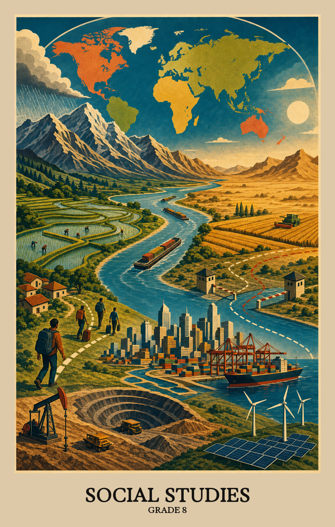
Students start the year learning how maps tell stories. They look at how mapmakers draw borders, name regions, and show landscapes, and they practice pulling information from maps, charts, and satellite images.
Students look at where natural resources sit on the planet and why that matters. They connect rivers, soil, oil, and forests to the jobs people do and the choices countries make about land.
Students travel the globe on paper, studying the Americas, Europe, Russia, Africa, the Middle East, Asia, and the Pacific. For each region they learn major cities, landforms, cultures, and how people make a living.
Students study where people live, why families move from one country or city to another, and how growing populations change a place. They compare richer and poorer countries and what daily life looks like in each.
Students close the year looking at how trade, the internet, and shipping tie countries together, and how disputes over borders, rivers, and resources pull them apart. They practice backing up an argument with evidence from real sources.
Reading maps, weighing evidence, and thinking through how economic choices play out are all part of this work. Students practice the reasoning skills that run through every part of history, geography, and civics.
Students pull facts from maps, charts, photos, and written sources, then piece them together to explain what a region of the world is like.
Students use maps and geographic data to spot patterns in how people and places change over time, then predict where those patterns might lead.
Students write questions about historical events, maps, and economic choices, then dig into sources to figure out what actually happened and why it matters.
Students look at several sources on the same topic, compare what they find, and build a written argument backed by that evidence.
Students look at the same event or issue from multiple angles, such as a soldier's view versus a civilian's, or a merchant's view versus a farmer's, and explain how those viewpoints differ and what they share.
Students trace why an event happened and what it set in motion. In history and geography, that means following a chain of decisions, actions, and consequences from start to finish.
Students apply a decision-making framework to a real choice, such as a trade policy or a personal financial decision, and explain what motivated that choice and what it cost or gained.
Students practice talking and listening respectfully with people who see things differently. The goal is to disagree without shutting the conversation down.
Students research a world geography topic and turn their findings into a finished product, such as a map, report, or presentation, that shows what they learned.
Students compare multiple sources on the same event, checking each one for bias or propaganda before drawing conclusions about what actually happened and why.
| Standard | Definition | Code |
|---|---|---|
| The student will demonstrate skills for historical thinking, geographical… | Reading maps, weighing evidence, and thinking through how economic choices play out are all part of this work. Students practice the reasoning skills that run through every part of history, geography, and civics. | S.WG |
| selecting and synthesizing evidence from information sources, including | Students pull facts from maps, charts, photos, and written sources, then piece them together to explain what a region of the world is like. | S.WG.a |
| applying geographic skills to determine and predict patterns and movement of… | Students use maps and geographic data to spot patterns in how people and places change over time, then predict where those patterns might lead. | S.WG.b |
| developing questions, enhancing curiosity | Students write questions about historical events, maps, and economic choices, then dig into sources to figure out what actually happened and why it matters. | S.WG.c |
| investigating and analyzing evidence from multiple sources to construct… | Students look at several sources on the same topic, compare what they find, and build a written argument backed by that evidence. | S.WG.d |
| comparing and contrasting historical, cultural, economic | Students look at the same event or issue from multiple angles, such as a soldier's view versus a civilian's, or a merchant's view versus a farmer's, and explain how those viewpoints differ and what they share. | S.WG.e |
| determining and explaining cause-and-effect relationships | Students trace why an event happened and what it set in motion. In history and geography, that means following a chain of decisions, actions, and consequences from start to finish. | S.WG.f |
| using economic decision-making models to analyze and explain the incentives for… | Students apply a decision-making framework to a real choice, such as a trade policy or a personal financial decision, and explain what motivated that choice and what it cost or gained. | S.WG.g |
| engaging and communicating as a civil and informed individual with persons with… | Students practice talking and listening respectfully with people who see things differently. The goal is to disagree without shutting the conversation down. | S.WG.h |
| developing products that reflect an understanding of research, content | Students research a world geography topic and turn their findings into a finished product, such as a map, report, or presentation, that shows what they learned. | S.WG.i |
| contextualizing, corroborating | Students compare multiple sources on the same event, checking each one for bias or propaganda before drawing conclusions about what actually happened and why. | S.WG.j |
Geographic information (maps, satellite images, data) shapes real decisions about where to build roads, plan cities, or respond to disasters. Students learn how to read and use these tools to explain why location matters.
Regions get nicknames like "the Rust Belt" or "the Sun Belt" because they share something in common. Students explain how shared features, whether climate, industry, or landscape, cause a place to be grouped and labeled the way it is.
Regional landscapes show the mix of the physical world and the people who live there. Students explain how a place looks the way it does because of its landforms, climate, and the culture of its residents.
Students examine how shared languages, religions, and ethnic backgrounds can connect neighboring regions or create sharp divisions between them.
Maps are made by people with their own perspectives, so the same region can look very different depending on who drew it. Students learn to read those choices and sketch rough maps from memory to show what they already know about a place.
| Standard | Definition | Code |
|---|---|---|
| The student will apply history and social science skills to explain how… | Geographic information (maps, satellite images, data) shapes real decisions about where to build roads, plan cities, or respond to disasters. Students learn how to read and use these tools to explain why location matters. | WG.1 |
| explaining how characteristics of regions have led to regional labels | Regions get nicknames like "the Rust Belt" or "the Sun Belt" because they share something in common. Students explain how shared features, whether climate, industry, or landscape, cause a place to be grouped and labeled the way it is. | WG.1.a |
| describing how regional landscapes reflect the physical environment and the… | Regional landscapes show the mix of the physical world and the people who live there. Students explain how a place looks the way it does because of its landforms, climate, and the culture of its residents. | WG.1.b |
| analyzing how cultural characteristics, including the world’s major languages… | Students examine how shared languages, religions, and ethnic backgrounds can connect neighboring regions or create sharp divisions between them. | WG.1.c |
| explaining how cartography is used to reflect regional perspectives, point of… | Maps are made by people with their own perspectives, so the same region can look very different depending on who drew it. Students learn to read those choices and sketch rough maps from memory to show what they already know about a place. | WG.1.d |
Natural resources (like water and forests), human resources (labor and skills), and capital resources (tools and factories) all shape how economies grow. Students analyze why each type matters and how countries use them to build wealth.
Students compare where natural resources like oil, fresh water, and farmland are found around the world, and think about why some regions have more than others.
Students study how natural resources like oil, farmland, or rivers shape where industries grow and how land gets used. A region rich in coal mines differently than one rich in fertile soil.
Students read arguments from different sides of a real resource debate, like drilling for oil or building a dam, and explain why people disagree based on who benefits and who pays the cost.
| Standard | Definition | Code |
|---|---|---|
| The student will apply history and social science skills to evaluate the… | Natural resources (like water and forests), human resources (labor and skills), and capital resources (tools and factories) all shape how economies grow. Students analyze why each type matters and how countries use them to build wealth. | WG.2 |
| comparing the distribution of major natural resources throughout world regions | Students compare where natural resources like oil, fresh water, and farmland are found around the world, and think about why some regions have more than others. | WG.2.a |
| showing the influence of resources on patterns of economic activity and land use | Students study how natural resources like oil, farmland, or rivers shape where industries grow and how land gets used. A region rich in coal mines differently than one rich in fertile soil. | WG.2.b |
| evaluating perspectives regarding the use of resources | Students read arguments from different sides of a real resource debate, like drilling for oil or building a dam, and explain why people disagree based on who benefits and who pays the cost. | WG.2.c |
Students learn to group parts of the United States and Canada into regions, then explain what makes each area distinct, from its landscape and climate to how people live and work there.
Students locate major regions and cities across the United States and Canada on maps, explaining what makes each area distinct from the others.
Students identify major landforms, waterways, and climate zones across the United States and Canada, then explain how forces like erosion, weather, and human activity slowly reshape those features over time.
Students look at how religion, language, food, and other cultural traditions have shaped the look and feel of different parts of the United States and Canada, from the buildings people construct to the neighborhoods they build.
Students study how goods, jobs, and industries are spread across different parts of the United States and Canada, and how those regions trade with countries around the world.
Students sort Latin American and Caribbean countries into regions, then explain what makes each region distinct, using geography, climate, and culture as the lens.
Students locate and label the major regions and cities of Latin America and the Caribbean on maps, then explain what the patterns they see reveal about where people settled and why.
Students describe the mountains, rivers, rainforests, and coastlines that shape Latin America and the Caribbean, and explain how those physical features can shift over time through erosion, climate change, or human activity.
Students look at how history, language, religion, and daily life have shaped what cities, farms, and neighborhoods in Latin America and the Caribbean look like today.
Students learn why some parts of Latin America grow crops, others drill for oil, and others run factories, and how those goods move into global trade.
Students break Europe into regions and study what makes each one distinct, looking at geography, climate, culture, and economy to explain why the borders between regions exist where they do.
Students locate Europe's major geographic regions and cities on maps. They practice reading where places actually sit in relation to each other, not just naming them.
Students describe the mountains, rivers, coastlines, and other physical features that shape different parts of Europe, then explain how those features can shift over time through erosion, climate, or human activity.
Students study how the art, religion, language, and history of a place shape what it looks, sounds, and feels like. They connect those cultural details to specific regions across Europe.
Students study how Europe's economy is organized: which industries and jobs show up in which places, and how European countries trade with the rest of the world.
Students study Russia and Central Asia as a region, looking at what shapes life there: the land, the climate, the economies, and the cultures that connect or divide the countries.
Students locate and study the major regions and cities of Russia and Central Asia on maps, explaining what the geography of each place reveals about how people live there.
Students identify Russia and Central Asia's major landforms, rivers, and climate zones, then explain how geography shifts over time through events like erosion, resource extraction, or climate change.
Culture shapes the look and feel of a place. Students examine how religion, language, and traditions in Russia and Central Asia have influenced the buildings, cities, and land use people can see on the ground today.
Students explain how Russia and Central Asia earn money and trade with the rest of the world, including which industries and resources are concentrated in specific areas and why those locations matter economically.
Students study the countries, landscapes, and cultures south of the Sahara Desert, grouping them into regions based on shared geography, climate, and history.
Students locate and study the major regions and cities of sub-Saharan Africa on maps and a globe, then explain what those locations reveal about how people and places are connected.
Students identify major landforms, rivers, and climate zones across sub-Saharan Africa, then explain how those features shift over time through erosion, drought, or other natural changes.
Students look at how religion, language, art, and daily life have shaped the villages, cities, and land use across sub-Saharan Africa's regions.
Students identify where farming, mining, and trade happen across sub-Saharan Africa and explain how those activities connect the region to global markets.
Students identify what makes North Africa and Southwest Asia distinct regions, looking at climate, landforms, resources, and how people live across both areas.
Students locate and examine the major geographic regions and cities of North Africa and Southwest Asia on maps. They explain what makes each area distinct and why its location matters.
Students identify the major landforms, bodies of water, and climate patterns across North Africa and Southwest Asia, then consider how those physical features can shift over time through forces like erosion, drought, or human activity.
Students look at how religion, language, and daily traditions have shaped the buildings, cities, and land use across North Africa and Southwest Asia.
Students learn how oil, farming, and trade shape the economies of North Africa and Southwest Asia. They look at where those activities happen and why they matter to the rest of the world.
Students study the countries, landforms, climates, and cultures that define South Asia and Southeast Asia, then sort those places into regions based on what they share.
Students locate the major regions and cities of South Asia and Southeast Asia on a map, then explain what that placement tells us about how people live and why those areas developed where they did.
Students identify the mountains, rivers, and coastlines that shape South Asia and Southeast Asia, then explain how natural forces like erosion or climate can shift those features across time.
Students look at how religion, language, and daily life have shaped the cities, farms, and built environments of South Asia and Southeast Asia over time.
Students explain how jobs and industries are spread across South Asia and Southeast Asia, and how those countries trade with the rest of the world.
Students examine the countries, landforms, climates, and cultures that make up East Asia to understand what sets that part of the world apart from other regions.
Students locate and study major cities and geographic regions of East Asia on maps. They explain what makes each area distinct, from mountain ranges to coastal plains.
Students identify the mountains, rivers, plains, and coastlines that shape East Asia, then consider how those physical features shift over time through natural forces or human activity.
Students examine how religion, language, art, and history shaped what East Asian cities, towns, and rural areas look like today.
Students learn where farming, manufacturing, and trade happen across East Asia and why those industries are concentrated in certain places. They also look at how the region connects to global markets.
Students study Australia, New Zealand, and the Pacific Islands as a region, examining the physical landscape, climate, cultures, and economies that shape how people live there.
Students locate and compare the major geographic regions and cities of Australia and the Pacific Islands on maps, then explain how location shapes what those places look and feel like.
Students describe the major landforms, waterways, and ecosystems of Australia and the Pacific Islands, then explain how natural forces like erosion, volcanic activity, or climate shifts can reshape those features across time.
Students look at how language, religion, and settlement history have shaped the way towns, farms, and land use are distributed across Australia and the Pacific Islands.
Students explain how Australia and the Pacific Islands make money and trade with the rest of the world. That includes where farming, mining, and industry are concentrated and which goods move in and out of the region.
| Standard | Definition | Code |
|---|---|---|
| The student will analyze the characteristics of the regions of the United… | Students learn to group parts of the United States and Canada into regions, then explain what makes each area distinct, from its landscape and climate to how people live and work there. | WG.3 |
| identifying and analyzing the location of major geographic regions and major… | Students locate major regions and cities across the United States and Canada on maps, explaining what makes each area distinct from the others. | WG.3.a |
| describing major physical and environmental features and how geography… | Students identify major landforms, waterways, and climate zones across the United States and Canada, then explain how forces like erosion, weather, and human activity slowly reshape those features over time. | WG.3.b |
| analyzing cultural influences and landscapes | Students look at how religion, language, food, and other cultural traditions have shaped the look and feel of different parts of the United States and Canada, from the buildings people construct to the neighborhoods they build. | WG.3.c |
| explaining important economic characteristics, including the distribution… | Students study how goods, jobs, and industries are spread across different parts of the United States and Canada, and how those regions trade with countries around the world. | WG.3.d |
| The student will analyze the characteristics of the regions of Latin America… | Students sort Latin American and Caribbean countries into regions, then explain what makes each region distinct, using geography, climate, and culture as the lens. | WG.4 |
| identifying and analyzing the location of major geographic regions and major… | Students locate and label the major regions and cities of Latin America and the Caribbean on maps, then explain what the patterns they see reveal about where people settled and why. | WG.4.a |
| describing major physical and environmental features and how geography… | Students describe the mountains, rivers, rainforests, and coastlines that shape Latin America and the Caribbean, and explain how those physical features can shift over time through erosion, climate change, or human activity. | WG.4.b |
| analyzing cultural influences and landscapes | Students look at how history, language, religion, and daily life have shaped what cities, farms, and neighborhoods in Latin America and the Caribbean look like today. | WG.4.c |
| explaining important economic characteristics, including the distribution… | Students learn why some parts of Latin America grow crops, others drill for oil, and others run factories, and how those goods move into global trade. | WG.4.d |
| The students will analyze the characteristics of the regions of Europe by | Students break Europe into regions and study what makes each one distinct, looking at geography, climate, culture, and economy to explain why the borders between regions exist where they do. | WG.5 |
| identifying and analyzing the location of major geographic regions and major… | Students locate Europe's major geographic regions and cities on maps. They practice reading where places actually sit in relation to each other, not just naming them. | WG.5.a |
| describing major physical and environmental features and how geography… | Students describe the mountains, rivers, coastlines, and other physical features that shape different parts of Europe, then explain how those features can shift over time through erosion, climate, or human activity. | WG.5.b |
| analyzing cultural influences and landscapes | Students study how the art, religion, language, and history of a place shape what it looks, sounds, and feels like. They connect those cultural details to specific regions across Europe. | WG.5.c |
| explaining important economic characteristics, including the distribution… | Students study how Europe's economy is organized: which industries and jobs show up in which places, and how European countries trade with the rest of the world. | WG.5.d |
| The student will analyze the characteristics of the regions of Russia and… | Students study Russia and Central Asia as a region, looking at what shapes life there: the land, the climate, the economies, and the cultures that connect or divide the countries. | WG.6 |
| identifying and analyzing the location of major geographic regions and major… | Students locate and study the major regions and cities of Russia and Central Asia on maps, explaining what the geography of each place reveals about how people live there. | WG.6.a |
| describing major physical and environmental features and how geography… | Students identify Russia and Central Asia's major landforms, rivers, and climate zones, then explain how geography shifts over time through events like erosion, resource extraction, or climate change. | WG.6.b |
| analyzing cultural influences and landscapes | Culture shapes the look and feel of a place. Students examine how religion, language, and traditions in Russia and Central Asia have influenced the buildings, cities, and land use people can see on the ground today. | WG.6.c |
| explaining important economic characteristics, including the distribution… | Students explain how Russia and Central Asia earn money and trade with the rest of the world, including which industries and resources are concentrated in specific areas and why those locations matter economically. | WG.6.d |
| The student will analyze the characteristics of the regions of sub-Saharan… | Students study the countries, landscapes, and cultures south of the Sahara Desert, grouping them into regions based on shared geography, climate, and history. | WG.7 |
| identifying and analyzing the location of major geographic regions and major… | Students locate and study the major regions and cities of sub-Saharan Africa on maps and a globe, then explain what those locations reveal about how people and places are connected. | WG.7.a |
| describing major physical and environmental features and how geography… | Students identify major landforms, rivers, and climate zones across sub-Saharan Africa, then explain how those features shift over time through erosion, drought, or other natural changes. | WG.7.b |
| analyzing cultural influences and landscapes | Students look at how religion, language, art, and daily life have shaped the villages, cities, and land use across sub-Saharan Africa's regions. | WG.7.c |
| explaining important economic characteristics, including the distribution… | Students identify where farming, mining, and trade happen across sub-Saharan Africa and explain how those activities connect the region to global markets. | WG.7.d |
| The student will analyze the characteristics of the regions of North Africa… | Students identify what makes North Africa and Southwest Asia distinct regions, looking at climate, landforms, resources, and how people live across both areas. | WG.8 |
| identifying and analyzing the location of major geographic regions and major… | Students locate and examine the major geographic regions and cities of North Africa and Southwest Asia on maps. They explain what makes each area distinct and why its location matters. | WG.8.a |
| describing major physical and environmental features and how geography… | Students identify the major landforms, bodies of water, and climate patterns across North Africa and Southwest Asia, then consider how those physical features can shift over time through forces like erosion, drought, or human activity. | WG.8.b |
| analyzing cultural influences and landscapes | Students look at how religion, language, and daily traditions have shaped the buildings, cities, and land use across North Africa and Southwest Asia. | WG.8.c |
| explaining important economic characteristics, including the distribution… | Students learn how oil, farming, and trade shape the economies of North Africa and Southwest Asia. They look at where those activities happen and why they matter to the rest of the world. | WG.8.d |
| The student will analyze the characteristics of the regions of South Asia and… | Students study the countries, landforms, climates, and cultures that define South Asia and Southeast Asia, then sort those places into regions based on what they share. | WG.9 |
| identifying and analyzing the location of major geographic regions and major… | Students locate the major regions and cities of South Asia and Southeast Asia on a map, then explain what that placement tells us about how people live and why those areas developed where they did. | WG.9.a |
| describing major physical and environmental features and how geography… | Students identify the mountains, rivers, and coastlines that shape South Asia and Southeast Asia, then explain how natural forces like erosion or climate can shift those features across time. | WG.9.b |
| analyzing cultural influences and landscapes | Students look at how religion, language, and daily life have shaped the cities, farms, and built environments of South Asia and Southeast Asia over time. | WG.9.c |
| explaining important economic characteristics, including the distribution… | Students explain how jobs and industries are spread across South Asia and Southeast Asia, and how those countries trade with the rest of the world. | WG.9.d |
| The student will analyze the characteristics of the East Asian region by | Students examine the countries, landforms, climates, and cultures that make up East Asia to understand what sets that part of the world apart from other regions. | WG.10 |
| identifying and analyzing the location of major geographic regions and major… | Students locate and study major cities and geographic regions of East Asia on maps. They explain what makes each area distinct, from mountain ranges to coastal plains. | WG.10.a |
| describing major physical and environmental features and how geography… | Students identify the mountains, rivers, plains, and coastlines that shape East Asia, then consider how those physical features shift over time through natural forces or human activity. | WG.10.b |
| analyzing cultural influences and landscapes | Students examine how religion, language, art, and history shaped what East Asian cities, towns, and rural areas look like today. | WG.10.c |
| explaining important economic characteristics, including the distribution… | Students learn where farming, manufacturing, and trade happen across East Asia and why those industries are concentrated in certain places. They also look at how the region connects to global markets. | WG.10.d |
| The student will analyze the characteristics of the Australian and Pacific… | Students study Australia, New Zealand, and the Pacific Islands as a region, examining the physical landscape, climate, cultures, and economies that shape how people live there. | WG.11 |
| identifying and analyzing the location of major geographic regions and major… | Students locate and compare the major geographic regions and cities of Australia and the Pacific Islands on maps, then explain how location shapes what those places look and feel like. | WG.11.a |
| describing major physical and environmental features and how geography… | Students describe the major landforms, waterways, and ecosystems of Australia and the Pacific Islands, then explain how natural forces like erosion, volcanic activity, or climate shifts can reshape those features across time. | WG.11.b |
| analyzing cultural influences and landscapes | Students look at how language, religion, and settlement history have shaped the way towns, farms, and land use are distributed across Australia and the Pacific Islands. | WG.11.c |
| explaining important economic characteristics, including the distribution… | Students explain how Australia and the Pacific Islands make money and trade with the rest of the world. That includes where farming, mining, and industry are concentrated and which goods move in and out of the region. | WG.11.d |
Reading population maps and charts, students explain why some regions are crowded while others are nearly empty, and how birth rates, death rates, and migration shift the size and makeup of populations over time.
Students read population data like birth rates, life expectancy, and income levels to figure out how wealthy or developed a country is. A place with high child mortality and low incomes tells a different story than one with long life spans and steady wages.
Developed countries tend to have higher incomes, better hospitals, and more schooling. Students compare those conditions with developing countries, where many people still lack reliable access to those same basics.
Students compare countries to see how wealth connects to everyday life: whether people can find good jobs, how free they are, and how much their government shapes their choices.
Students examine why people move, from job shortages to war to climate, and how those migrations reshape cities, countries, and cultures over time. Wait, I used an em dash. Let me redo. Students examine why people move, from job shortages to war to climate shifts, and how those migrations reshape cities, countries, and cultures over time.
Students read population data like graphs and tables to describe how groups of people differ by size, age, or location. They compare that data across countries or regions to draw conclusions about where people live and why.
Students examine why people move from one place to another, what changes when large numbers arrive or leave a community, and how governments and societies respond.
| Standard | Definition | Code |
|---|---|---|
| The student will apply social science skills to understand the distribution… | Reading population maps and charts, students explain why some regions are crowded while others are nearly empty, and how birth rates, death rates, and migration shift the size and makeup of populations over time. | WG.12 |
| examining the relationship between demographic data to determine the level of… | Students read population data like birth rates, life expectancy, and income levels to figure out how wealthy or developed a country is. A place with high child mortality and low incomes tells a different story than one with long life spans and steady wages. | WG.12.a |
| distinguishing between developed and developing countries | Developed countries tend to have higher incomes, better hospitals, and more schooling. Students compare those conditions with developing countries, where many people still lack reliable access to those same basics. | WG.12.b |
| comparing and contrasting the level of economic development to the standard of… | Students compare countries to see how wealth connects to everyday life: whether people can find good jobs, how free they are, and how much their government shapes their choices. | WG.12.c |
| The student will apply history and social science skills to understand… | Students examine why people move, from job shortages to war to climate, and how those migrations reshape cities, countries, and cultures over time. Wait, I used an em dash. Let me redo. Students examine why people move, from job shortages to war to climate shifts, and how those migrations reshape cities, countries, and cultures over time. | WG.13 |
| explaining how data is used to describe and compare populations | Students read population data like graphs and tables to describe how groups of people differ by size, age, or location. They compare that data across countries or regions to draw conclusions about where people live and why. | WG.13.a |
| analyzing the causes, impacts | Students examine why people move from one place to another, what changes when large numbers arrive or leave a community, and how governments and societies respond. | WG.13.b |
Students study how cultures around the world have shaped each other over time, looking at how shared customs, beliefs, and ideas spread, collide, and change across different regions and eras.
Cultural identity is built from shared language, religion, customs, and geography. Students identify what ties people to a group and how those shared traits show up in the places where people live.
Students trace how ideas in science, math, medicine, and the arts passed between cultures over time, explaining how a discovery or practice in one part of the world spread and shaped thinking elsewhere.
Students trace why people move from farms and small towns to cities, and what happens to both places as a result. They look at real migration patterns across the world and explain the forces pushing or pulling people toward cities.
Students learn why cities were built where they were. Site means the physical spot itself (a harbor, a hilltop), and situation means the city's location relative to trade routes, resources, and nearby populations.
Students study how towns and cities have shifted from farming and trading hubs to centers of industry, services, and technology. The focus is on why people moved to cities and how those reasons have changed across different periods in history.
| Standard | Definition | Code |
|---|---|---|
| The student will apply history and social science skills to determine cultural… | Students study how cultures around the world have shaped each other over time, looking at how shared customs, beliefs, and ideas spread, collide, and change across different regions and eras. | WG.14 |
| identifying and describing characteristics that contribute to cultural… | Cultural identity is built from shared language, religion, customs, and geography. Students identify what ties people to a group and how those shared traits show up in the places where people live. | WG.14.a |
| explaining the intellectual exchanges among cultures, including | Students trace how ideas in science, math, medicine, and the arts passed between cultures over time, explaining how a discovery or practice in one part of the world spread and shaped thinking elsewhere. | WG.14.b |
| The student will apply history and social science skills to analyze the… | Students trace why people move from farms and small towns to cities, and what happens to both places as a result. They look at real migration patterns across the world and explain the forces pushing or pulling people toward cities. | WG.15 |
| applying the concepts of site and situation to major cities in each region | Students learn why cities were built where they were. Site means the physical spot itself (a harbor, a hilltop), and situation means the city's location relative to trade routes, resources, and nearby populations. | WG.15.a |
| explaining how the functions of towns and cities have changed over time | Students study how towns and cities have shifted from farming and trading hubs to centers of industry, services, and technology. The focus is on why people moved to cities and how those reasons have changed across different periods in history. | WG.15.b |
Countries, companies, and people depend on each other more than ever for goods, jobs, and ideas. Students study how that web of connections shapes daily life, economies, and world events.
Students look at why factories, farms, and businesses cluster in certain parts of the world and why countries buy and sell goods across borders. Things like natural resources, labor costs, and transportation shape where economic activity lands.
Students look at how goods, money, and information move between countries, and examine what those connections mean for people in different parts of the world.
| Standard | Definition | Code |
|---|---|---|
| The student will apply history and social science skills to understand the… | Countries, companies, and people depend on each other more than ever for goods, jobs, and ideas. Students study how that web of connections shapes daily life, economies, and world events. | WG.16 |
| examining factors that influence the distribution of economic activities and… | Students look at why factories, farms, and businesses cluster in certain parts of the world and why countries buy and sell goods across borders. Things like natural resources, labor costs, and transportation shape where economic activity lands. | WG.16.a |
| analyzing global trade and communication networks | Students look at how goods, money, and information move between countries, and examine what those connections mean for people in different parts of the world. | WG.16.b |
Strategic locations like mountain passes, rivers, and coastlines have shaped how nations gain power and protect territory. Students analyze why control of these features has driven conflict and cooperation throughout history.
Students look at real places where countries disagree over where a border sits, such as a contested coastline or region, and explain what is driving the dispute, whether land, resources, or history.
Students look at real conflicts between countries and explain what caused them, whether the dispute was over land, resources, trade, or political power.
Students study why countries fight over or share rivers, lakes, and coastal waters. They look at real disputes over flooding, fishing rights, and water access to understand how geography shapes what nations argue about and agree on.
| Standard | Definition | Code |
|---|---|---|
| The student will apply history and social science skills to analyze strategic… | Strategic locations like mountain passes, rivers, and coastlines have shaped how nations gain power and protect territory. Students analyze why control of these features has driven conflict and cooperation throughout history. | WG.17 |
| identifying and describing examples of disputed borders and explaining the… | Students look at real places where countries disagree over where a border sits, such as a contested coastline or region, and explain what is driving the dispute, whether land, resources, or history. | WG.17.a |
| describing and explaining examples of the different types of conflicts that may… | Students look at real conflicts between countries and explain what caused them, whether the dispute was over land, resources, trade, or political power. | WG.17.b |
| analyzing the types of conflicts and cooperation that can occur over the use of… | Students study why countries fight over or share rivers, lakes, and coastal waters. They look at real disputes over flooding, fishing rights, and water access to understand how geography shapes what nations argue about and agree on. | WG.17.c |
Standards of Learning history and social science assessments, including Virginia Studies and Civics and Economics.
Alternate assessment program for eligible students with significant cognitive disabilities, covering state-tested grades and subjects.
Federally administered sample-based assessment in reading, mathematics, science, writing, and other subjects. NAEP results inform state-by-state comparisons rather than individual student or school accountability.
Students study world geography region by region, including North America, Latin America, Europe, Russia and Central Asia, Africa, the Middle East, Asia, and the Pacific. For each region they look at the land, the people, the cultures, and how people make a living.
Keep a world map or globe somewhere visible at home, like the fridge or a bedroom wall. When a country shows up in the news or in a movie, spend two minutes finding it together and naming what is around it. Repetition builds the mental map faster than memorizing lists.
Students should be able to locate the major regions of the world, name a few key features of each, and explain how geography shapes how people live and trade. They should also be able to read a map, compare two regions, and back up a claim with evidence from a source.
Most teachers start with the skills unit and a short introduction to maps, resources, and population, then move region by region. Starting with North America and Latin America gives a familiar entry point before moving to Europe, Africa, Asia, and the Pacific. Save population, culture, and globalization themes to revisit inside each region.
Map locations fade fast without repeated practice, so build in short weekly map checks all year. Students also tend to confuse physical features with political borders, and they struggle to tell a developed economy from a developing one without concrete examples to anchor the idea.
Pick one country from the news each week and talk about where it is, what the land looks like, and what people there do for work. Cooking a dish from that country or watching a short travel clip makes the region stick. Ask students to point it out on a map before the conversation ends.
Memorizing every capital is not the goal. Students do need to know the major regions, the largest countries, and a handful of important cities well enough to find them on a map and place news stories in context. Knowing why a place matters counts for more than reciting its name.
Earlier grades focused on people and events over time. This year focuses on places and how geography, resources, and culture shape what happens there. Students still read sources and build arguments, but the questions are about regions and patterns rather than timelines.
Readiness shows up when students can read a map or chart, pull evidence from a source, and write a short argument that compares two places or explains a cause and effect. If they can do that with a region they have not studied before, they are ready.